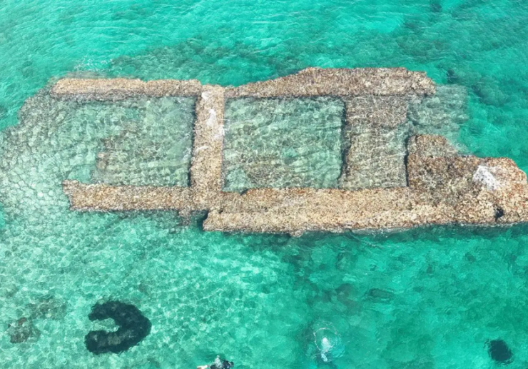
As part of a new research project led by the University of Salento, underwater and surface studies are being carried out to investigate underwater structures first identified in 2020 on the Le Cesine coastline.
Between San Cataldo and San Foca in Italy, there is a 6 kilometer natural preserve called Le Cesine. In the area of Posto San Giovanni, previous research utilizing drones, ROVs, and a photogrammetric survey found signs of a submerged port and buildings.
The foundation of a 90 meter long pier was unearthed by archaeologists 15 meters from the coast, at a depth of 3.5 meters, following the course of an old bank.
The pier was constructed using big blocks put in close proximity to one another and maybe some parallelepiped blocks with cylinder-shaped sides spaced at fairly regular intervals, but it has since collapsed as a result of the destructive power of wave motion.
According to the researchers: “This structure is similar to the submerged part of the large Hadrianic pier north of the wide bay of San Cataldo, to which it is also similar due to its impressive development and building technique, but it could also be older than that.”
Another group of blocks on the same alignment that is further from the beach is set in parallel and perpendicular lines.
Purpose of the study is to thoroughly investigate both structures to see if they are connected, as well as a so-called “submerged church” that may really be the remnants of a lighthouse tower.
Additionally, there are buildings that the researchers are documenting on the beach, such as a collection of rock-cut storage pits and additional proof of a structure that early dating says may date from the Roman Empire era.
In a press release published by the University of Salento: “The set of evidence at sea and on land, with the holistic approach of landscape archaeology, suggests precisely the existence of an important port complex.”
